Stampede Solo
Velodirt has run this route as a one-day gravel epic since 2010. It always looked hard, but for whatever reason I always skipped it. Last year it was run in September and I balked at the high temps. Call me soft, but that’s fine - I try to be selective about my on-bike suffering. My theory is go hard, but save a little for tomorrow. I just recently watched the brilliant ESPN documentary about Jimmy Connors called “This is What They Want.” The reason I bring up Connors was his mother (yes, his mother coached him) Gloria’s approach to coaching: “The practice sessions were spirited and brief. They played every day, and she beat him every day. “I told him to try and knock the ball down my throat,” Gloria once explained to Sports Illustrated’s Frank Deford, “and he learned to do this because he found out that if I had the chance I would knock it down his.” But unlike today’s tennis prodigies, who are shipped off as young children to academies where their lives are consumed by tennis, Jimmy was never driven too hard. He says that “after a while she’d say, ‘You’ve had enough.’ I’d want to play more, but she’d tell me ‘go play basketball, go find your dog.’ She was always guarding against burnout.” As a result, Connors says, “every day I couldn’t wait to play tomorrow.” If you haven’t seen the ESPN documentary “This is What They Want” on Jimmy Connors go check it out on Netflix.
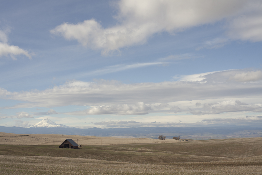
At some point you realize that a good weather window is a gift and that if you’re going to go, you might just have to go solo. I see the solo as a step in my progression with bikepacking. I did a couple hard solo rides in Arizona recently. One of them just about broke me, but that’s a post for the near future. Doing it solo allows you to ride your own pace, to leave when you have an opening in your schedule. It forces you to figure your shit out, to make sure your navigation is on point. We are so thankful for sites like Oregon Bikepacking. What a unique moment in time this is where we have websites dedicated to great, scenic routes that have been already been ridden. We can download a GPX track and go for it! I felt like there was just enough information provided where I roughly know what I was getting into. I knew there was a good market in Dufur at mile 40. I was pretty sure I could camp at the fairgrounds in Tygh Valley. I knew there was water at mile 56.6. I knew there was water at mile 71.6 at the White River Falls State Park. I knew if I needed it, I could get water in Grass Valley or Moro.
From Oregon Bikepacking site: “…Bikepacking this route over a weekend has always been on our radar and it’s gaining popularity. Starting in the Deschutes River State Recreation Area, you’ll get to climb high above the Deschutes enjoying mountain views from Rainier all the way down to the Sisters along some of the least traveled and most beautiful gravel roads anywhere in Oregon.
Highlights along the route include several of the nicest little towns Oregon has to offer, exploring the historic buildings in Friend, roughing it through the White River Wildlife Area, White River Falls, Sherar Falls, and a healthy supply of tumbleweeds to add character to your trip photos.”
From the Velodirt site:
“The route itself is not to be taken lightly. Expect lots of dirt and gravel with over 9,000 ft of climbing and some real rough riding in sections. There are well spaced services, but inconsistent cell service. As with all rides out this way, watch the weather for high winds and extreme temperatures.”
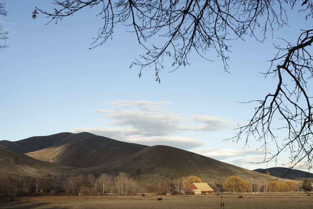
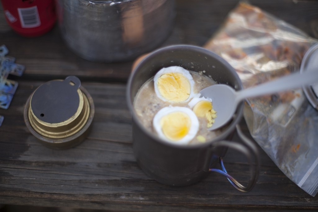
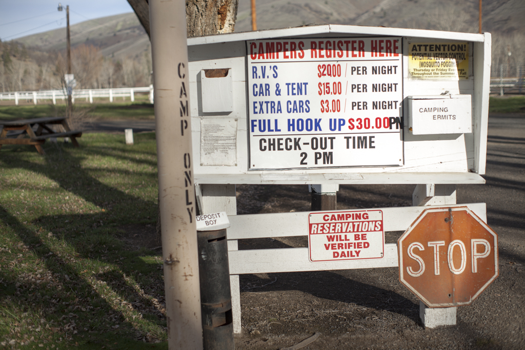
The other great thing about this route is its proximity to Portland. The start of the route is just 95 miles down 84 to the Deschutes River Recreation Area, where you can leave your car. Camping this time of the year is only $6/night. Strangely it’s $7/night to leave your car in the overnight parking lot, but I feel like spending the extra $1 per night is the right thing to do, and leave the camping spots free for campers. I decided to camp the night before since that would give me a chance to test my pad/bag/clothing combination before packing and setting off. I woke up at 7:00 but lingered in my tent. It was too cold to get up and start breakfast. The sun hadn’t worked its magic yet. But eventually it crept higher and I ventured out. I’ve come to rely on my homemade oatmeal packets, but I decided I needed eggs as well. My new theory was just to hard boil 4 eggs. I’d eat two today here and take the extra two with me. It worked out perfectly. I could start packing up the tent while my oatmeal firmed up and the eggs boiled.
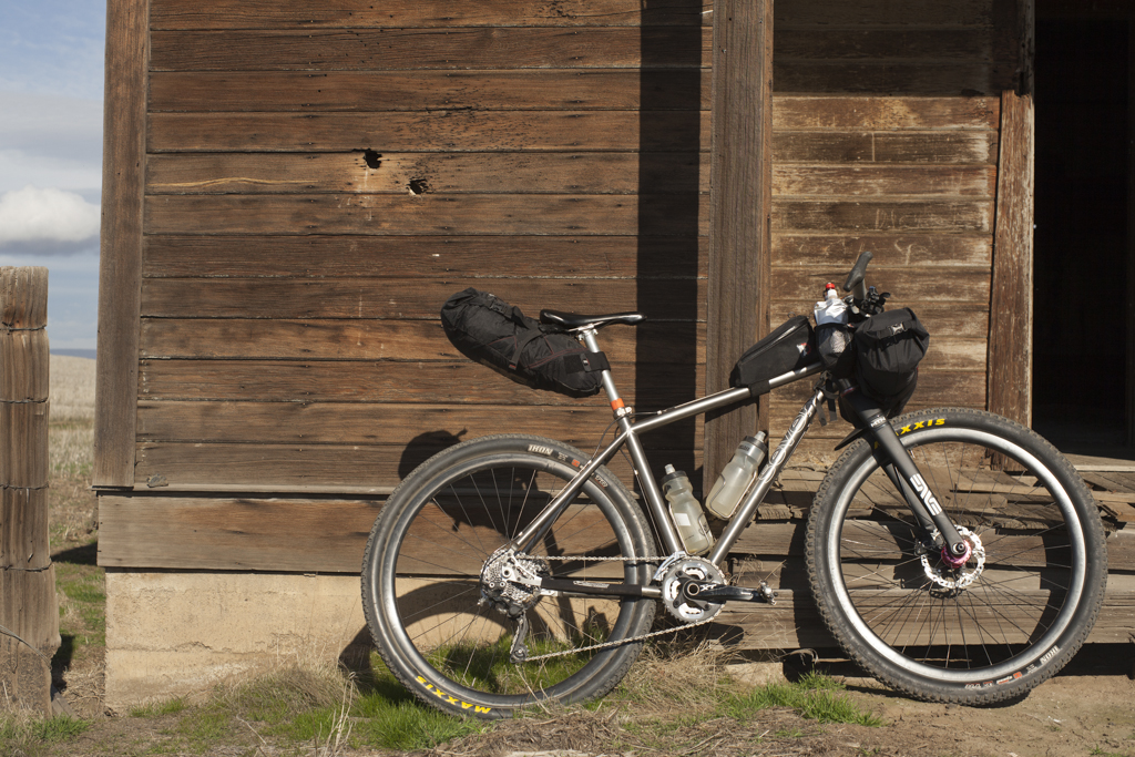
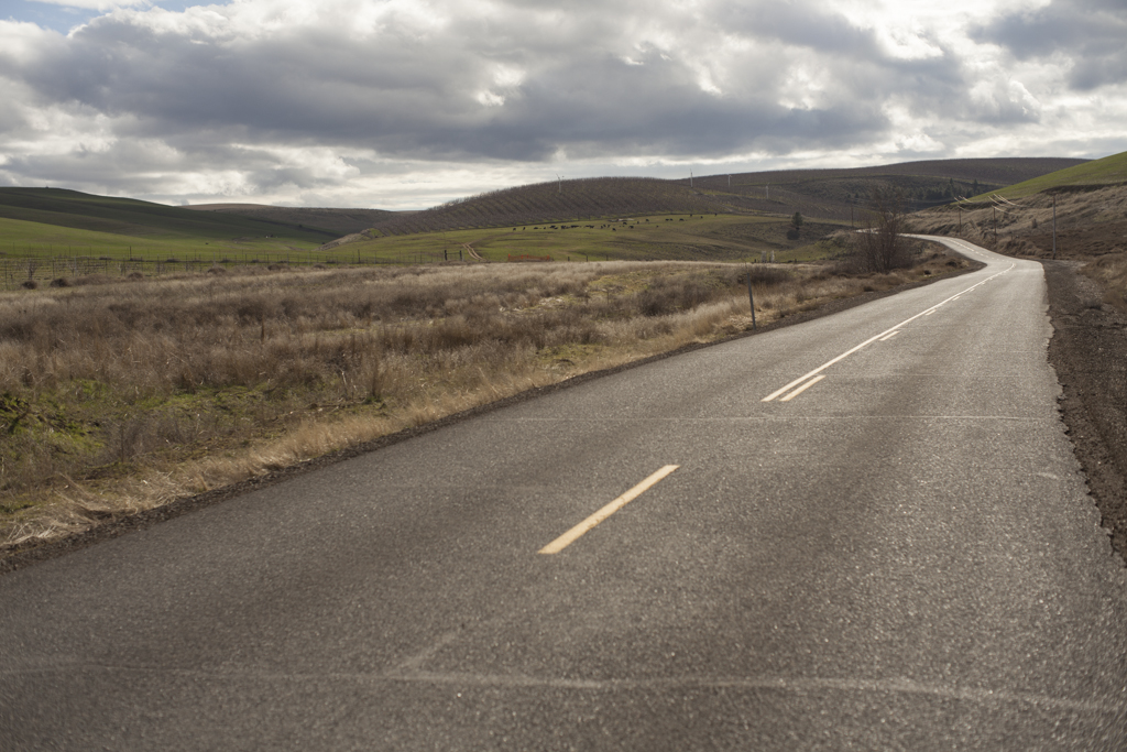
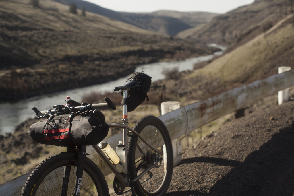
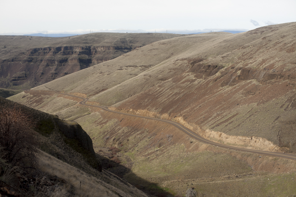
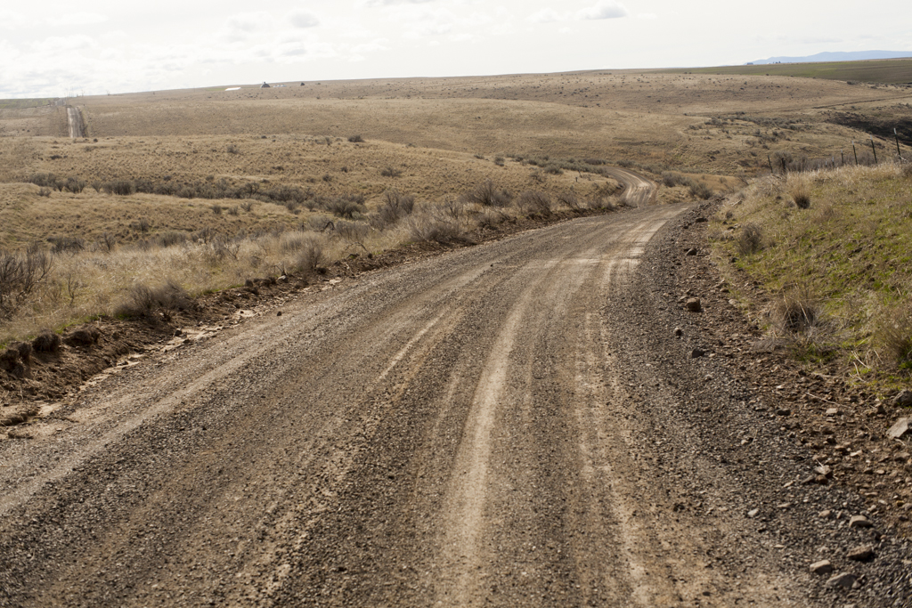
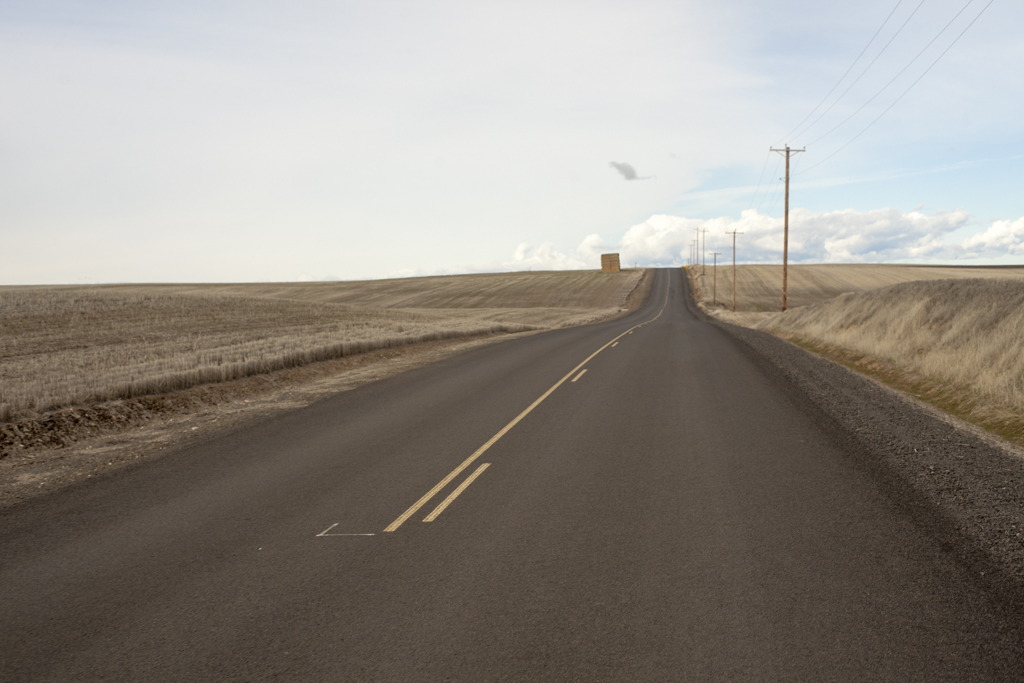
I didn’t overthink the packing on this trip, so I ended up bringing slightly more than I should have. I had two 24 ounce bottles of OSMO active on the bike with an extra 1.5 liters in my Osprey bladder. My theory is that it would take me 4 hours to get to Dufur and that there wouldn’t be any water sources on the route. If you’re unsure about your setup at the Deschutes Campground then the climb up Old Moody Road will let you know quickly how loaded climbing will feel. It’s a cruel start to the day, but you quickly earn spectacular views East down the gorge and get a feel for what the route will entail. If you’ve done the fantastic Dalles Mountain 60 route, you already know this part. It’s a scenic, rolling dirt road that parallels the Columbia River and heads back towards The Dalles. Though today, instead of riding 15 Mile Road back to The Dalles, I cross it and continue dirt road climbing on Company Hollow Road.
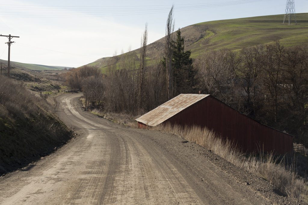
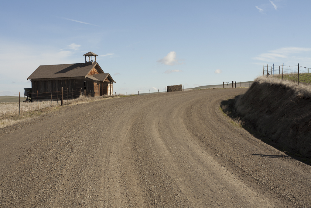
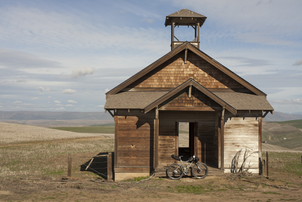
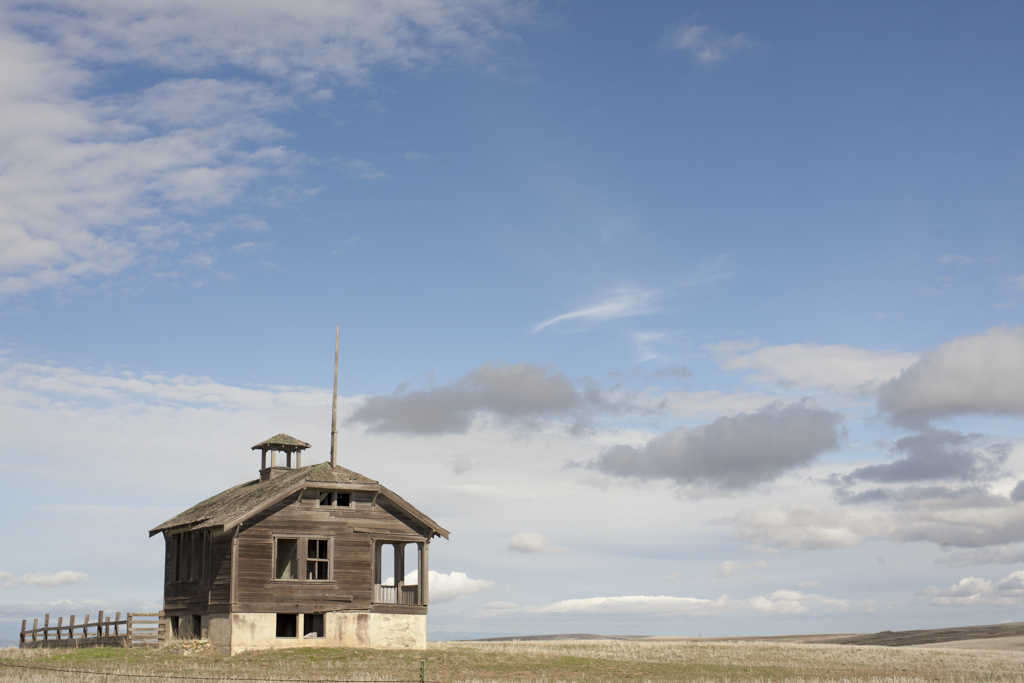
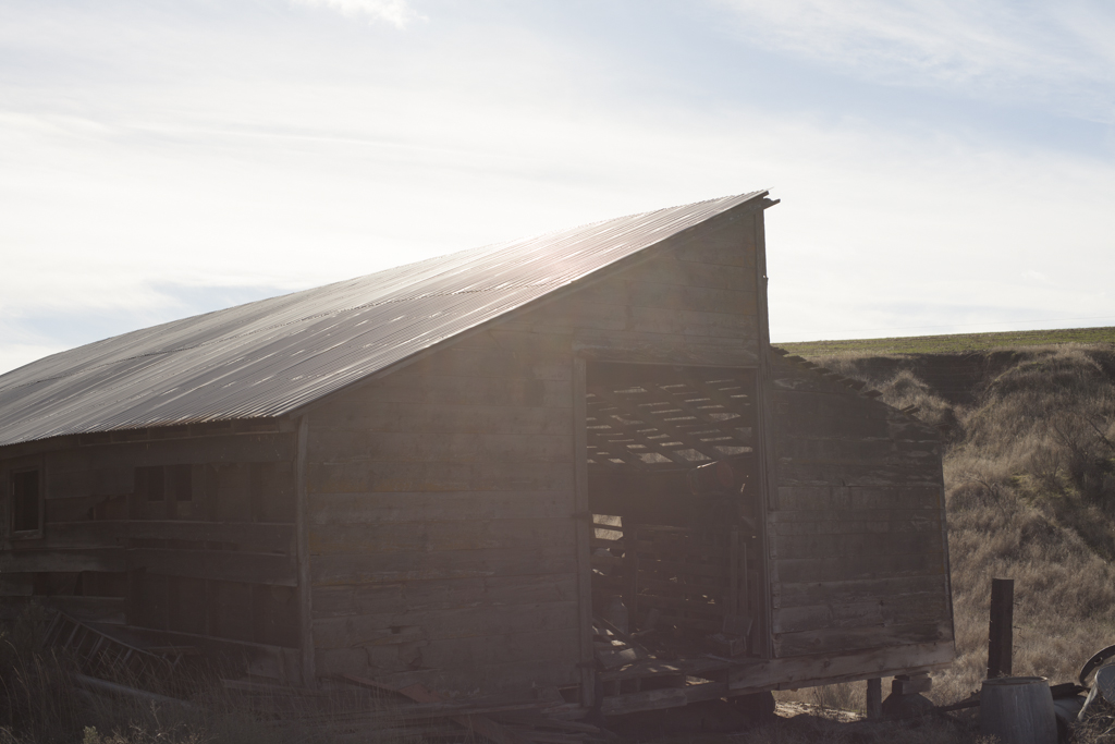
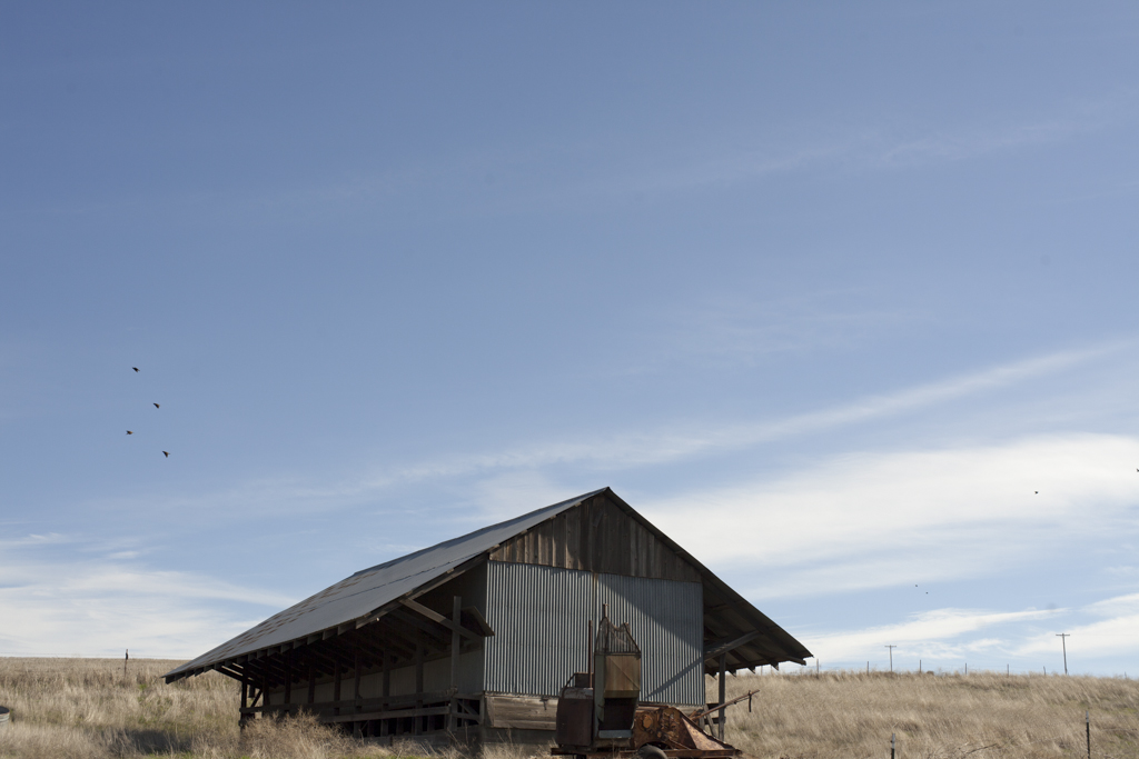
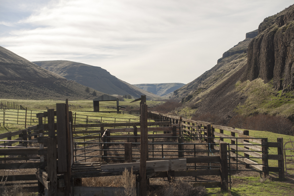
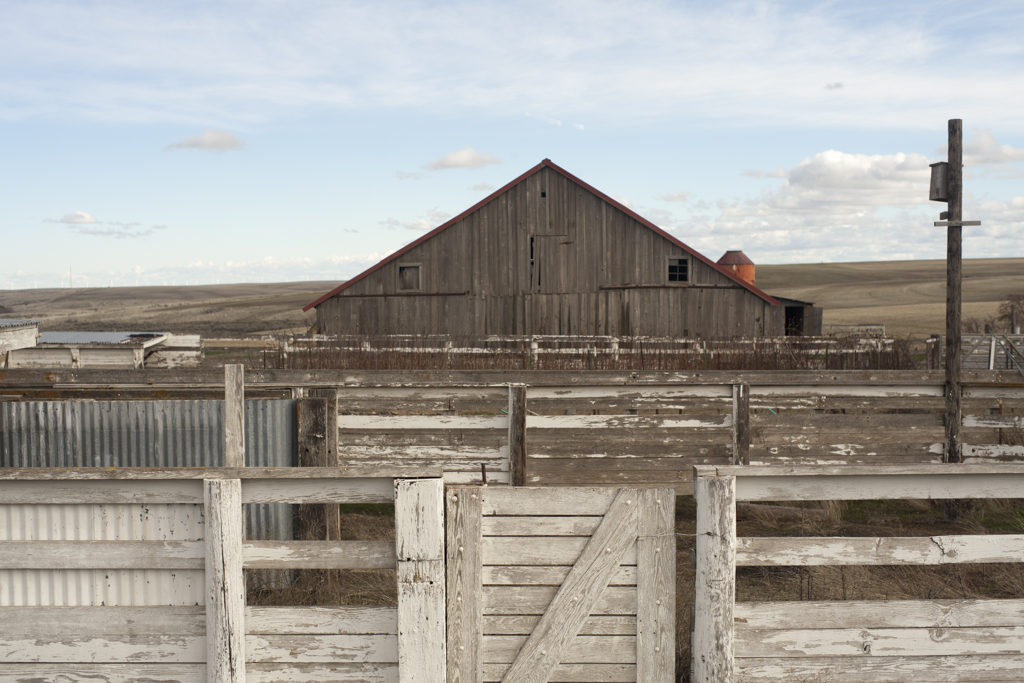
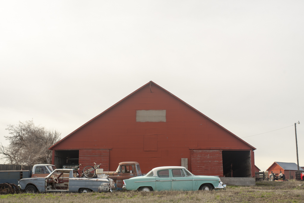
I love this part of the state. I think my first exposure to the area was photographing the Rapha Continental Dufur ride back in 2009. I fell in love with the undulating wheat fields and picture-perfect farms. I love how open and dry it is compared to the dense forest of the Cascades. But starting that climb up Company Hollow you’re reminded that it’s going to be a long day through some of the most beautiful and lonely roads in Oregon. The road to Dufur is not easy on a loaded mountain bike. There is about 1300 feet climbing in 40 miles. I kept imagining how much easier it would be on a road or cross bike. What would the pace be like in a group. Just as I’m getting sick of climbing I round the bend at about mile 17.5 and there is the most amazing abandoned schoolhouse. A little research reveals it's called the Douglas Hollow School. I'd be curious to learn more about it. It’s completely open, so you can go inside and explore. Fallen plaster covers the floors. I decide sitting in the sun on the porch is a perfect lunch spot.
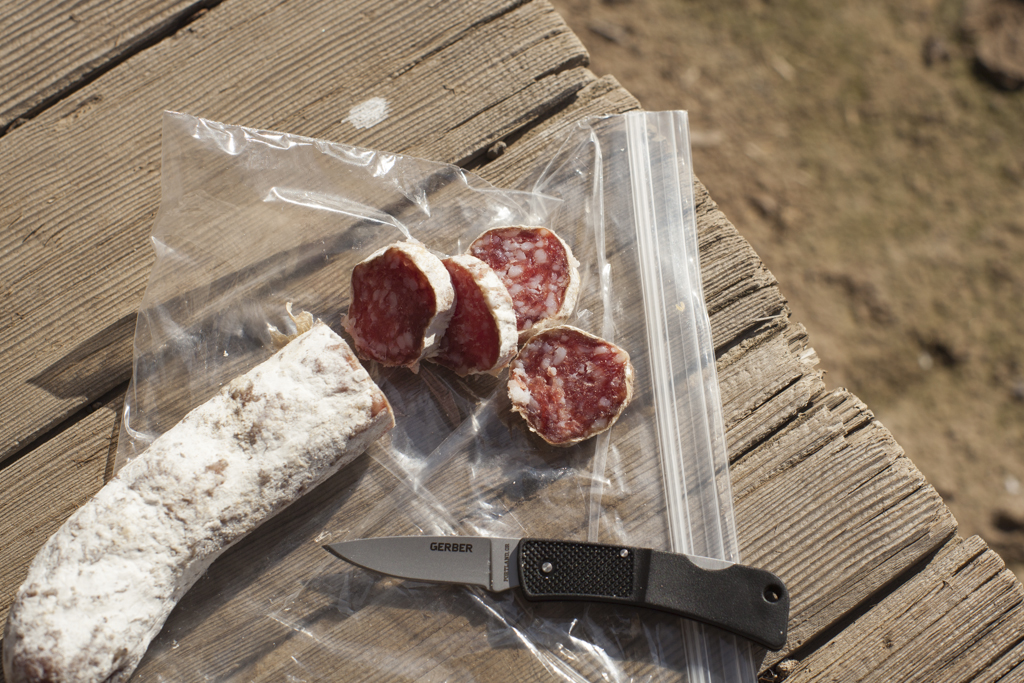
That might be the best part of a solo trip. I stop when I feel like it. I don’t feel rushed when I want to take a photo. I stop and snap photos and eat some salami and cheese and I enjoy being the only person out there. OK, one farmer did just drive by in a cloud of dust, but just one. I kept feeling like WOW it’s really pretty desolate out here, but at that moment I’d come across another farm or abandoned building.
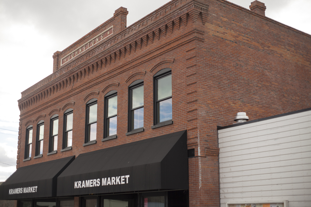
After my break, the road rips downhill and then slowly uphill again and then starts heading west. As soon as the road turns west at mile 28, the headwinds kick in and make the 12 miles to Dufur a bit of a grind. From experience I know that a bad headwind can make it impossible out here, and I know that this is only a 5 or a 6 on a scale of 10. Luckily I’ve been to Dufur before, so I know Kramer’s Market and it's deli await. Kramer’s is remarkably tidy for a historical building in the middle of nowhere. But Dufur is hardly the middle of nowhere. It’s only 14.3 miles from The Dalles if you take 197. I quickly unload my heavy backpack on a chair at the long communal table and order up a roast beef sandwich. I grab a bottled ice coffee from the cooler and call Tori. I think it was a little harder than I thought it would be and I pushed pretty hard to get here. I’m sweaty from the effort, although the 60 degree and slightly overcast weather couldn’t be milder. After I eat my sandwich and I start to get chilled, so I throw on my jacket and head back out after refilling bottles. I’m starting to doubt my progress at this point just a bit. I know I have only 25 miles to go, but I don’t know the route, so I want to get back to making progress on the bike.

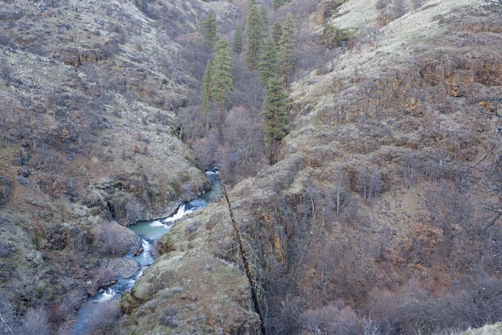
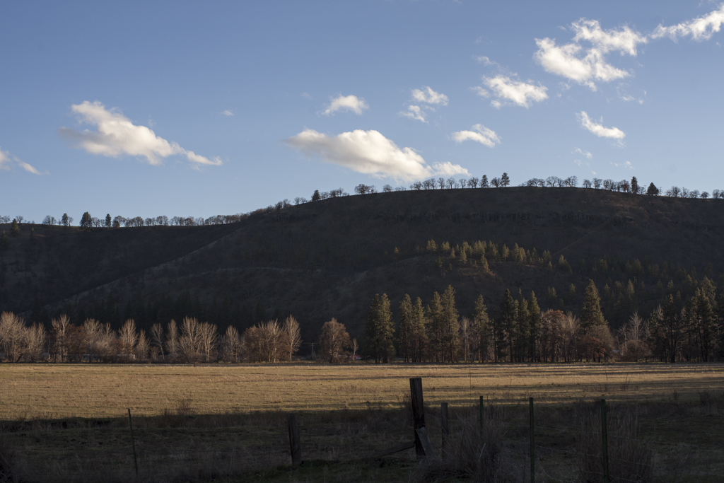
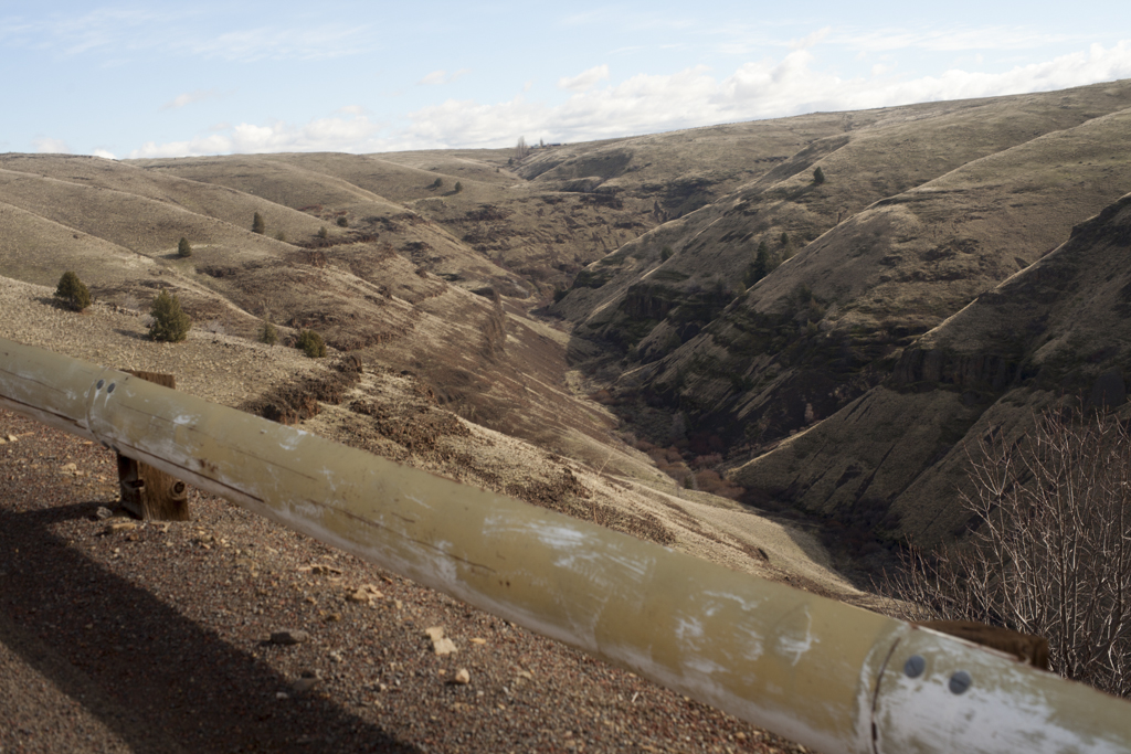
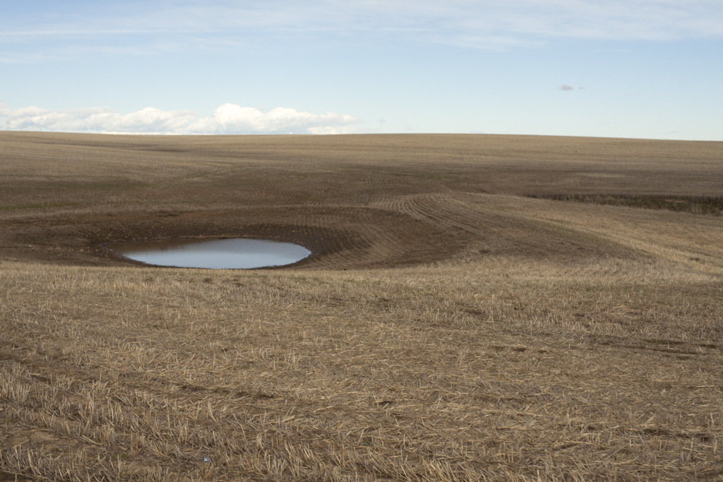
Heading out of town on Dufur Valley Road for a couple of miles with a quick Left and 3 miles worth of Rail Hollow Rd. Five miles out of Dufur the dirt climbing begins again in earnest with Winslow Road. I definitely feel like I’m in a different zone here and that I’m getting somewhere entirely new to me. It feels like high desert and pretty wild out here. The dirt rollers and extended climbing continue, but there are more descents on this part of the route. I feel like the miles are clicking by a bit faster now and before I know it I’m at the locked gate of the White River Wildlife Area. I’m a bit surprised to find a locked gate. Is it like this year round or just in the winter? Whatever…I don’t hesitate for more than 10 seconds and I’m hefting my rig over the gate and rolling down the road just as quickly. It feels a bit naughty and I’m definitely the only human in the area. I’m glad to have a GPX track to follow here, since there are many roads that diverge and look just as well traveled. At one point I take what looks like the obvious turn only to check my Garmin and see I chose wrong. That only happens once, but I can see how you could get lost in here. For the first time on this trip I’m happy to have a mountain bike. Water runs down the trail and I’m having to chose lines or get stuck in ruts and the occasional field of rock scrabble. What a treat, though! It’s gorgeous and it really makes the route feel like an adventure. I’m happy it’s not all dirt roads. By the third stream crossing I’m in the zone. I stop several times for photos.

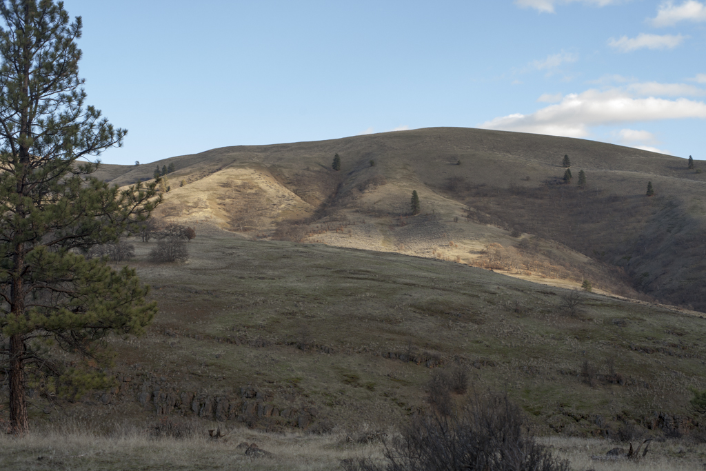
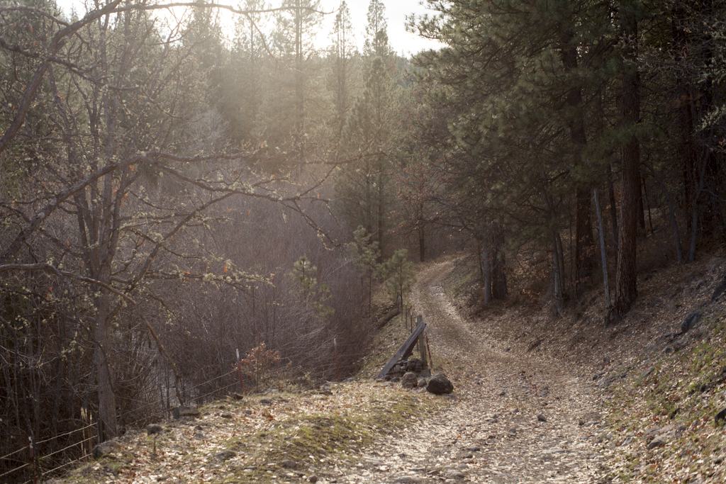
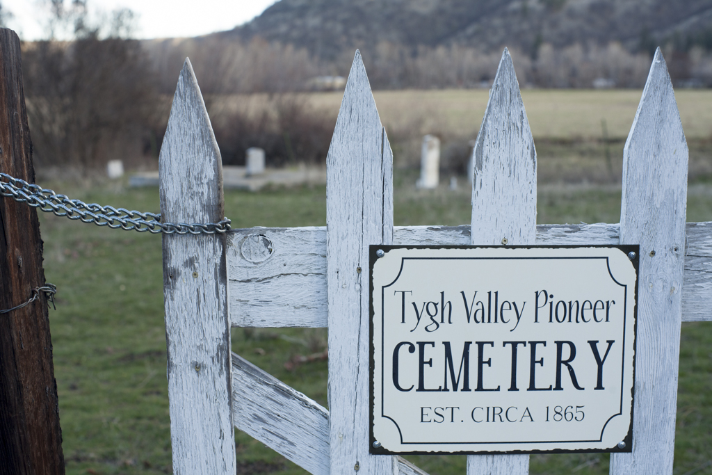
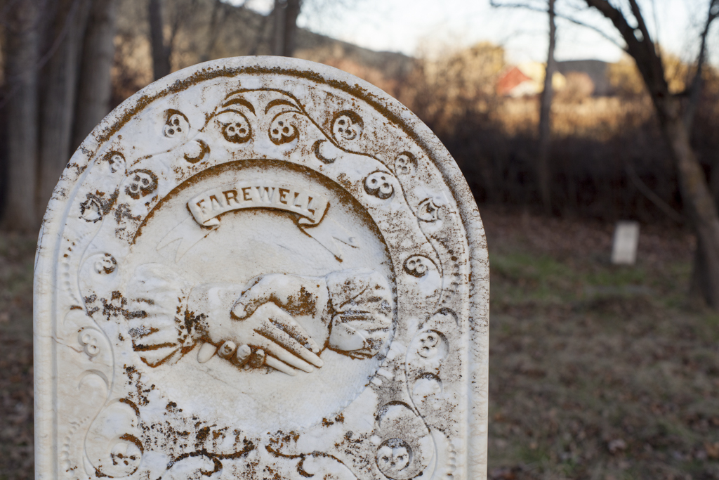
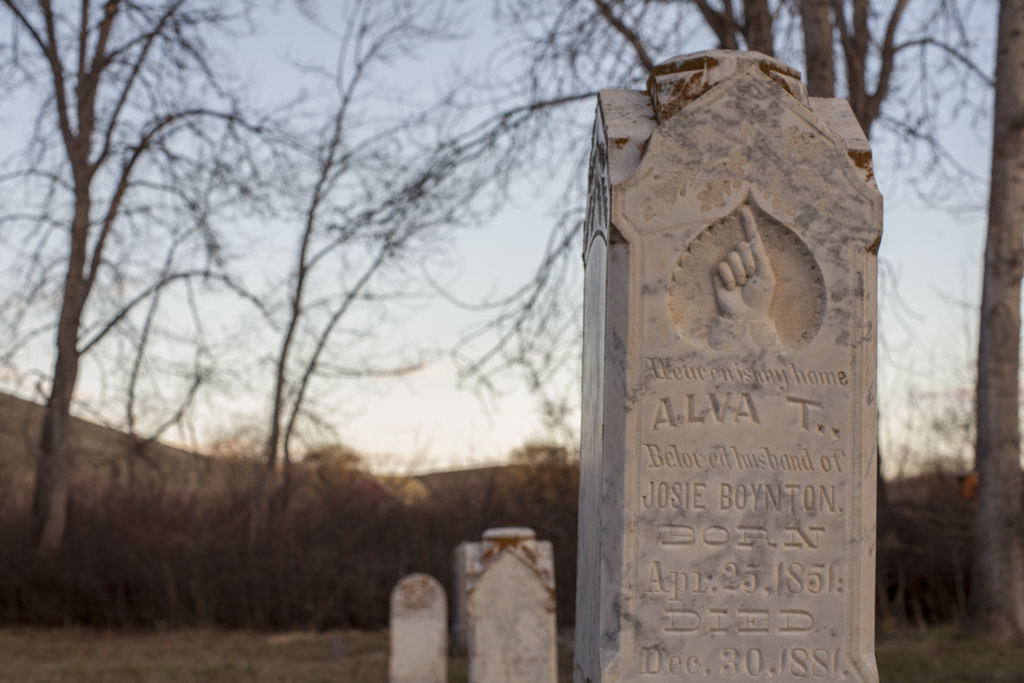
This is definitely an area that I’d like to come back to explore more. I’m still feeling like I need to push on a bit to Tygh Valley. I’d camp here, but I want to make a few more miles today and Donnie mentioned it could get cold in here this time of year and my sleep system is on the cold side, so I’ll push on. Just outside of the Wilderness area I stop to filter water for dinner and breakfast. At this point it’s all downhill and paved to Tygh Valley. A group of deer cross the road in front of me and bound effortlessly over barbed wire fence and into an empty field. Late afternoon light filters in through trees and I feel the euphoria of arriving in a new place under my own power. This is one of those moments where I feel golden. I know this is special. I savor it. I stop in an old pioneer cemetery and take photos.
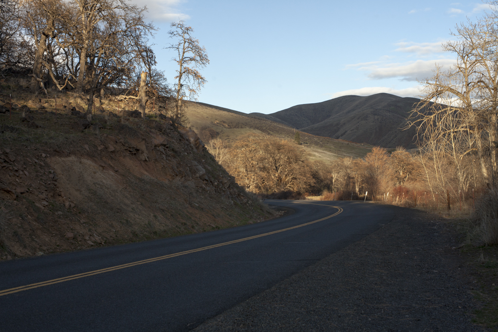

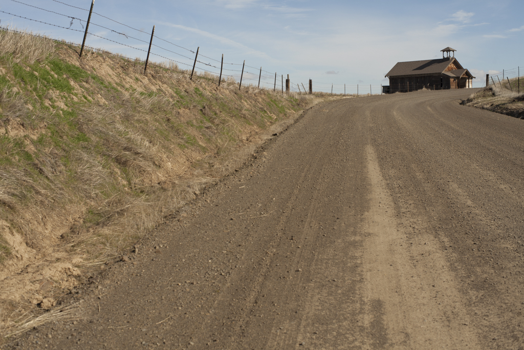
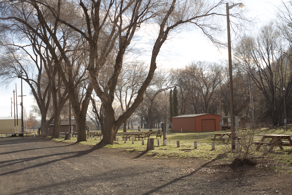
I love arriving at my destination at this hour. The road is gorgeous and curves back around towards town. Tonight I’ll be the only camper at the Fairgrounds - only human for that matter. No one comes out to ask what the heck I’m doing, so I set up next to a picnic table and start boiling water for dinner and setting up my tent. I just pumped water and I’ll be able to charge my phone in the outlets, so I’m all set. I’m surprised how few cars drive by. I’m not wasted tired, but lack sufficient curiosity to venture into town, so I just set up camp, eat buffalo chili and look at maps. It was a good day.
Day 2
I don’t know if it was the cold or being amped up from a long day of riding, but the night felt like it was half sleepless. I wake up to find frost covering everything and the bladder of water I left on the picnic table is frozen. It’s all I can do to pull myself out of my sleeping bag to boil water for coffee and oatmeal. I chop up my two hard-boiled eggs and add some roasted potatoes and sweet potatoes to the mix. It’s a hearty one-pot breakfast and I feel like I might be on to something here.

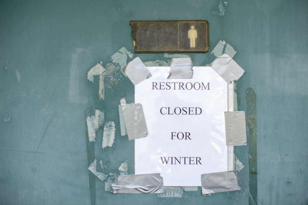
It’s not til this morning and I have the urge to do my daily duty that I realize what “Closed for winter” means. It means no running water and no toilet. Time to get creative. My chili Ziploc will have to do. The sun is just creeping over the hills as I break down the still-wet tent and repack my bags. It’s a couple miles to “downtown” Tygh Valley. I feel motivated to finish up early today. On the way out of town I notice Molly B’s diner. Had I not brought food, I'd be all over that.
The morning is still cool, but I warm up quickly as the road climbs a bit out of town. I quickly peel of my sweater and beanie. I kept thinking I’d fill up on water at a stream, but I realize the only water source is White River Falls State Park. But again I’m thwarted by “Closed for Winter” signs. I roll down the road a bit and opt to go knocking on a door asking for a spigot. A nice lady informs me that you can jump the gate to White River Falls to go get water. Now I know.
After a short climb I bomb down to the Deschutes River. The Deschutes is gorgeous and once again I’ve got it all to myself. Where is everyone? I stop for photos and think about the fishing platforms and Sherars Falls. The fishing platforms remind me of photos I’ve seen of Celilo falls from the 1950’s before the Dalles Dam was built in 1957. You can still see a few platforms from The Dalles Bridge on the Washington side of the Columbia.
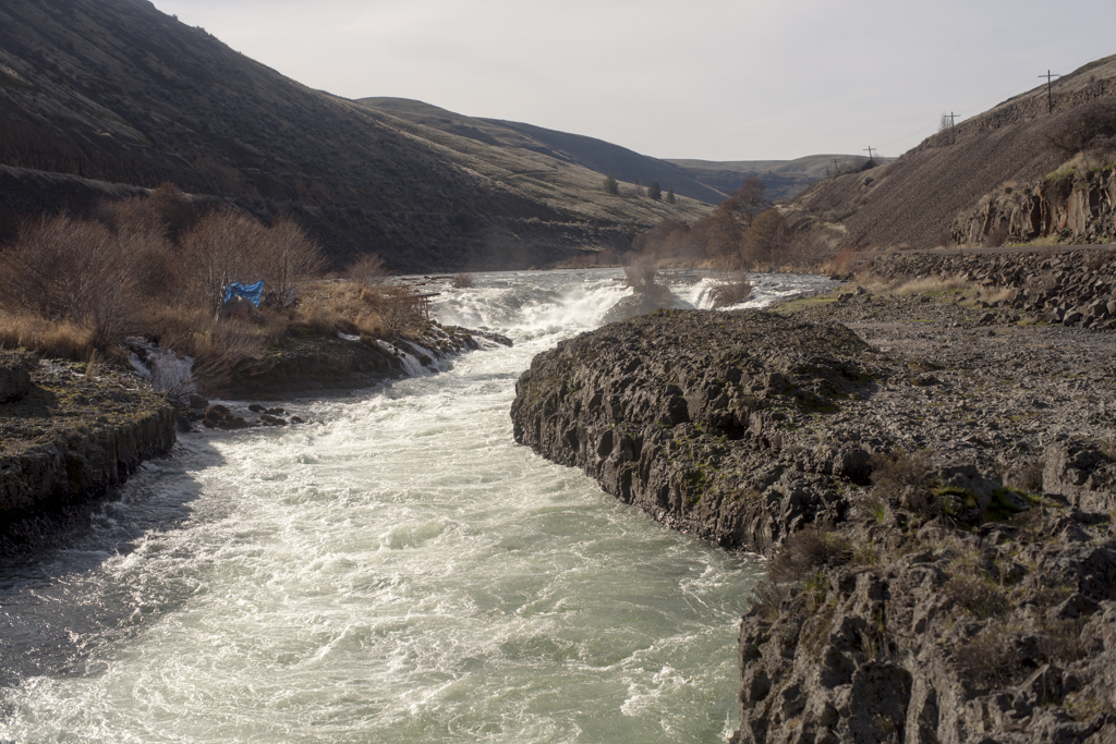
According to NW Waterfall Survey:
“Sherars Falls is the final waterfall along the Deschutes River. The falls drop about 15 feet into a narrow horseshoe shaped trough carved in the vast flood basalt formations blanketing eastern Oregon. The Deschutes has been heavily tapped for irrigation purposes and because of this Sherars Falls is not usually as burly as it could be with the river flowing naturally, but its still a fairly impressive cascade. The geology of the area is generally more interesting than the waterfall, river volume aside, and one can expect to see dozens of members of the Warm Springs Nation fishing at the falls - a long established tribal fishing ground. Sherars Falls was the site of a crossing point for local tribes as well as a sacred fishing ground. The falls are thought to have been discovered by Peter Skene Ogden in September of 1826. The first bridge was constructed below the falls in 1860 by John Todd, and rebuilt in 1862 after it washed away in floods. Through a series of transactions, the bridge was eventually transfered to Joseph Sherar, for whom the features were named.”
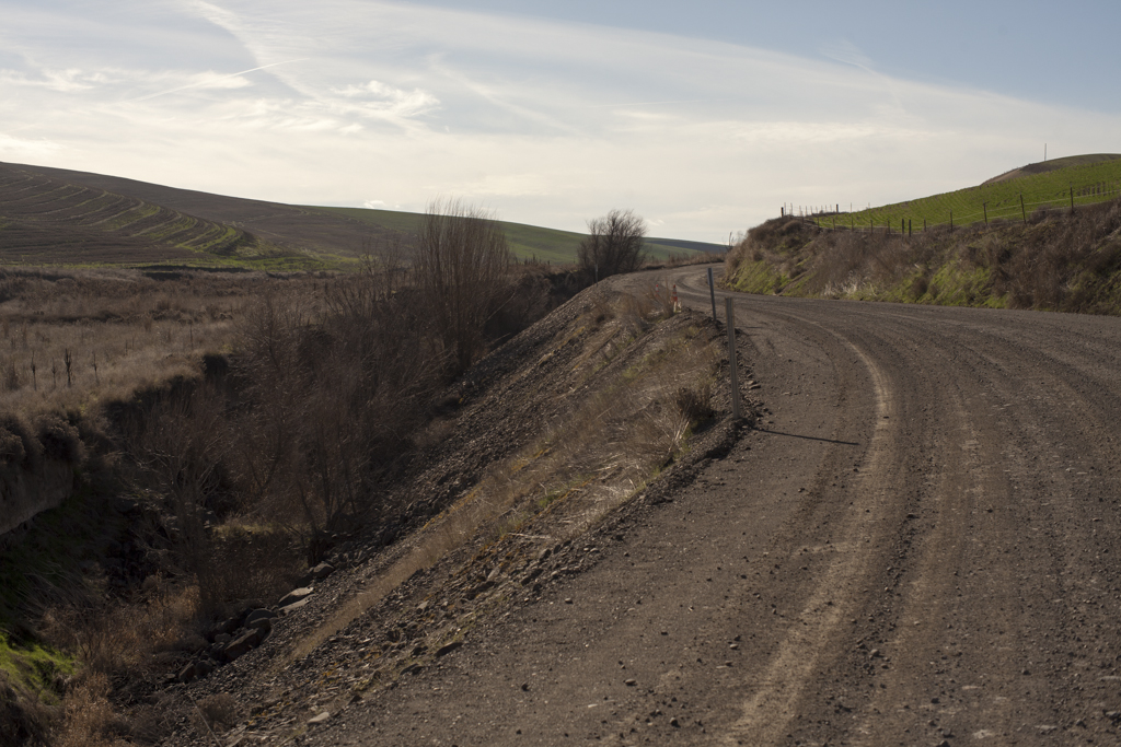
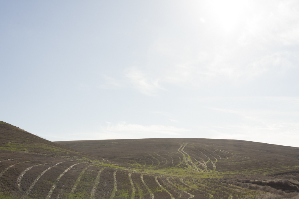
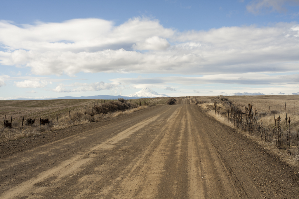
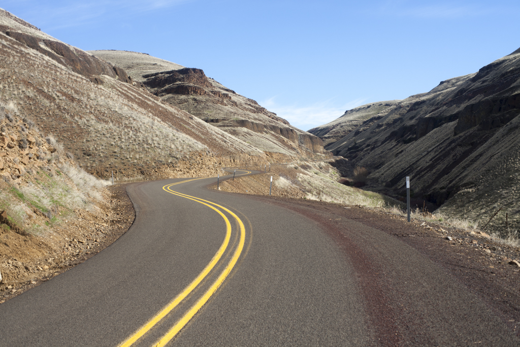
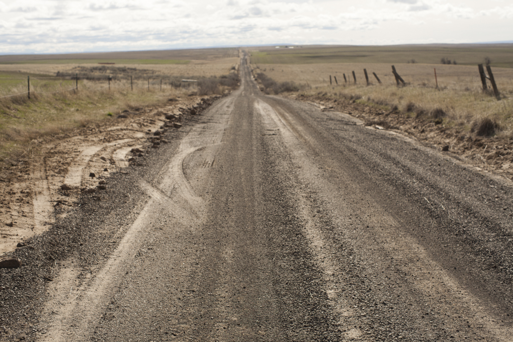
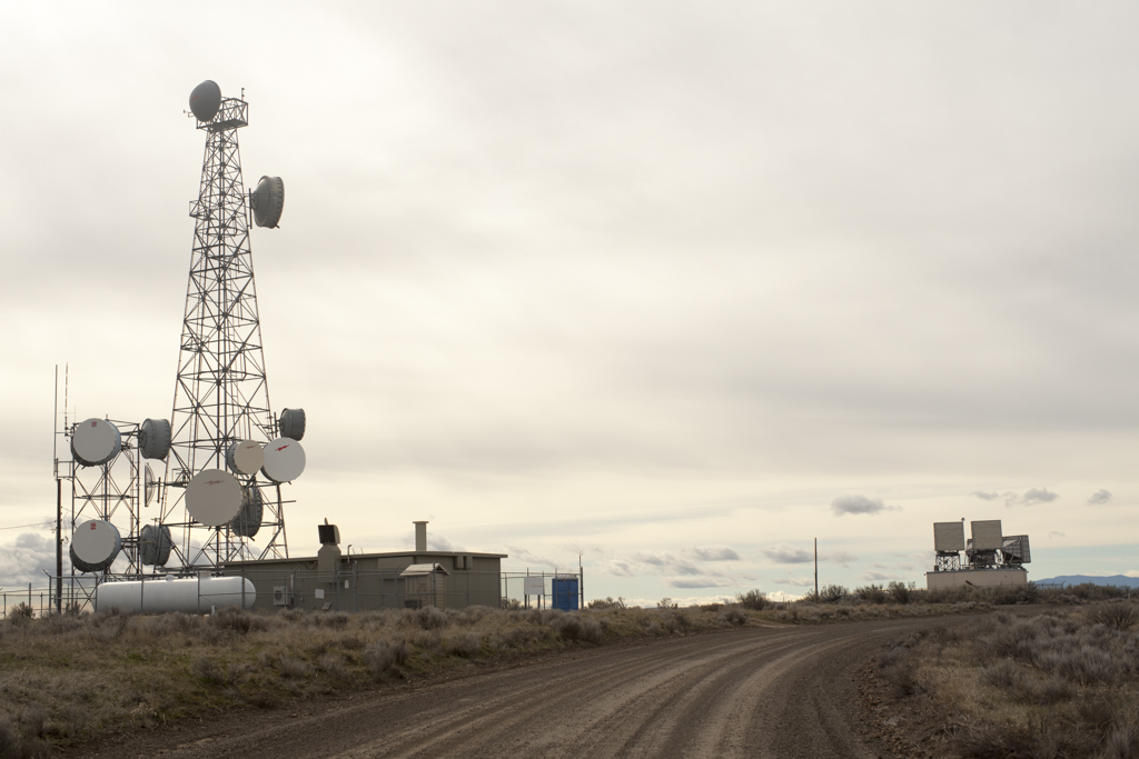
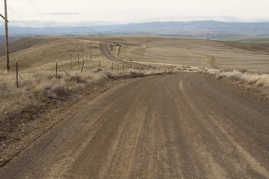
Once you leave the Deschutes you’ve got a spectacular 15 mile paved climb out of the River. The scenery really takes the edge off of the climb. I keep wondering where the road goes. It’s not until I’m passed by the Postman, one of the few cars I’ll see until I hit the Columbia. I keep thinking this is the last of the rollers – then I’ll be on top. But there is no “top” it just keeps going until you take a right turn onto dirt of Davis Rd. at mile 89. A left on Twin Lakes Rd. begins the long straight road flanked by high desert grasses and wheat fields and farms. I keep thinking I’m going to hit Grass Valley to fill up on water, but somehow when I see Stradley Rd I’m confused because I’m on Stradley Rd. but actually this is where Stradley becomes Sayrs Rd. And now that I’m home looking at satellite maps I realize that Grass Valley is probably only a mile off route. This is the hard part of the solo ride. These straight rollercoaster dirt roads have a way of breaking you down a bit with the sheer monotony. I don’t really have enough momentum to power over them like you would on your road bike on Skyline. Instead, you shift down and grind your loaded rig up the next and the next and then you do it again.
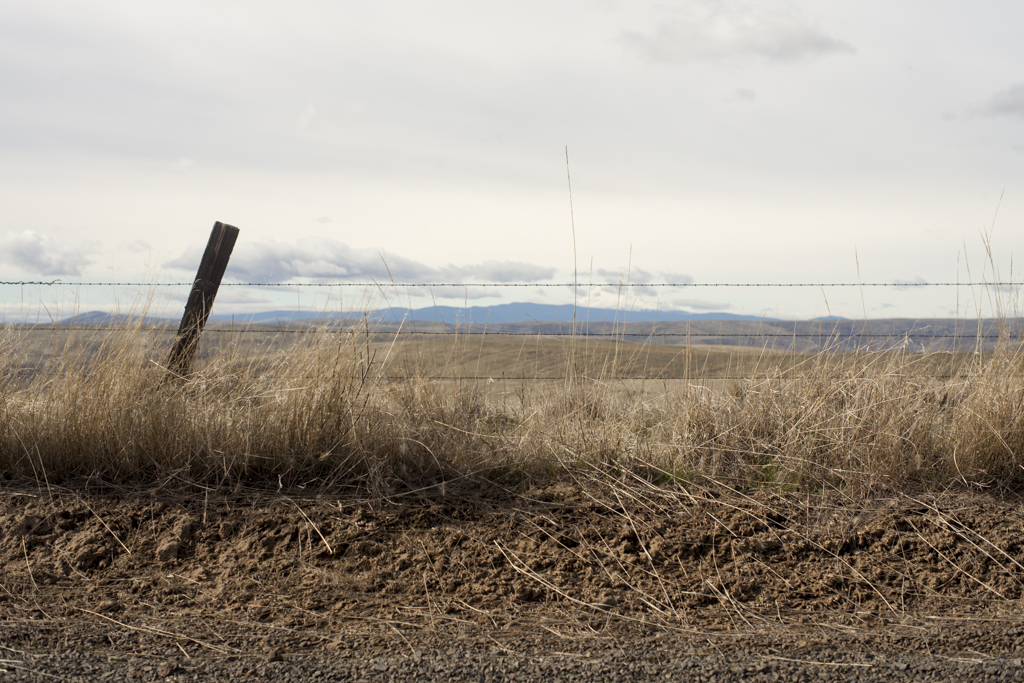
I have more than enough food. I feel like a lunch stop at a small town would be just thing for a mental break, but when I miss the road to Grass Valley, I start thinking about water in Moro. But by the time I reach Joe Peters Lane, which would start the 3 mile detour to Moro, six extra miles seems like a horrible idea. Instead, I see a faucet on a farm and that seems like a smarter option. I’m sure the bikepacker’s code says something about not knocking on a farmer’s door, but the resourceful traveler doesn’t have a problem with it. I shout hellos and look for angry dogs, but the coast is clear. I fill up my bottles, leaving no trace and keep rolling on Erskine Rd. At about mile 109, you take a hard left onto Gordon Ridge Rd. and you’re confronted with a final grunt of a climb to the ridge and the reality of the vicious headwind part of the ride.
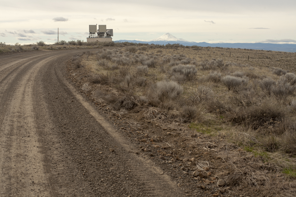

The views South from Gordon Ridge to the Deschutes are spectacular at this point and you begin a loose bomber descent. I was thankful to have mountain bike tires for this descent. I can only imagine it’s one of the more white-knuckle parts of the route for a road bike. Gordon Ridge turns back into pavement at about mile 115 and you’re starting to think about being done. The general thrust of the ride now is downhill, but you’ve still got a couple fake-out tailwind rollers before heading back into the increasingly strong headwinds as you approach the Columbia. The next 5 miles should be a ripper descent, but you have to pedal downhill into the wind just to keep moving, so effectively the steep grade of the descent is neutralized. Thankfully it’s only a mile and a half back to the campground once you reach 30. I finish at about 3:30 and see another couple of guys heading out with loaded panniers. They leave their car at the campground and I pull a note from the Ranger telling me I owe him two dollars since I left my car in overnight parking instead of just leaving it at a campsite. It seems really nitpicky, but I can’t let it get to me. I’m feeling satisfied having finished the route. I’m not destroyed, but mentally between the endless dirt rollers and the winds it was a good challenge and I’m glad to be done. I go sit under a tree by the Deschutes, watching ducks float by and look up towards Old Moody Rd. and think about how it felt to head out yesterday morning not knowing what I now know. The solo overnighter is a nice quick-fix outing. I’m pleased with my effort. Nothing crazy went down. I didn’t encounter another cyclist on route. I saw a few deer, some farmers in pickups, but I’m struck how easily it is to get away from the city and visit some very quiet parts of Oregon. Now that I’ve got a few rides under my belt, it feels natural to grab camping gear and food and get away for a couple days. This would be a great shakedown for Oregon Outback. In fact, the last 33 miles of the Outback are the same as the Stampede route. The Outback just climbs another 5000 feet over an additional 230 miles. The reason to do these ‘easy’ routes is that you build up your confidence and remind yourself of what works and what doesn’t. Speaking of which, here is a short list of what worked for me:
BIKE

Enve MTN fork.
So stoked on this piece of equipment, especially on these smoother dirt road routes. Between the 2.3 Maxxis Ikon tires, the 52mm rake and the compliance of the carbon combined make this a very comfortable ride, with zero loss of power through bobbing while climbing. Another bonus is that I’m carrying 2.5 fewer pounds by switching from the FOX Talas fork. That’s significant. However, I'll still use the FOX when the terrain demands.
Maxxis Ikon Tires. 2.2 rear 2.3 front. Tubeless,
3C EXC TR (translated: triple compound EXC sidewall protection, and tubeless ready) Maxxis recommends this tire for Hard Pack, Loose, Loose over Hard and Medium conditions, which is exactly the Stampede route. I ran these for the Bay Area Ridge Trail and they were perfect there as well. These will continue to be my go-to tire for this kind of route. I load them up with 4 oz. of Orange Seal sealant for peace of mind.

SLEEP SYSTEM
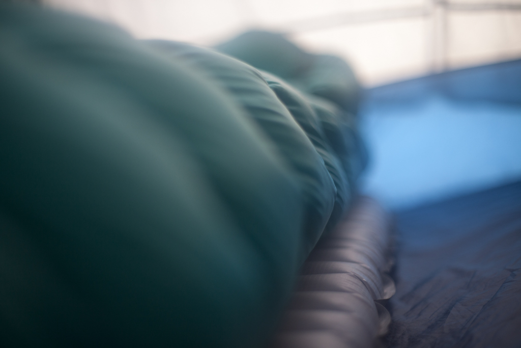
Big Sky International - Evolution 2P tent
This tent has been great for two people, when we can divide the load in half, but it’s a bit heavy for one person doing an overnighter. I was happy to have it for privacy and to keep the frost off at the Tygh Valley Fairgrounds. We’ll be testing smaller and lighter options for future overnighters.
Thermarest X-Therm Large pad
Awesome, warm, and comfortable pad. I think it made a huge difference in warmth considering I was using my 40 degree bag. Great winter pad. Highly recommended.
Western Mountaineering 40 degree bag.
I love this bag. It’s very light and very compressible. However, a 20 or 30 degree bag would be better for this time of year.
CLOTHING
Giro Wind Vest. .
Lightweight. (2.5 oz.) Vented back panel. Very packable. Loving this vest
Icebreaker Anatomica Long Sleeve shirt.
Great piece. Good weight and good amount of stretch. Very comfortable just using this as a base with the Houdini Jacket on top for day 2.
Patagonia Houdini jacket
When the wind was howling (as it does in the gorge) it still has a chill in late Feb. For under two ounces the Houdini does a great job of keeping warmth in. I put this over my down jacket in camp for extra warmth. Only negative is the hood acting like a parachute while riding.
SHOES
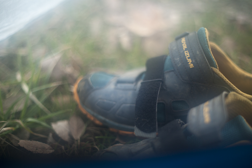
Pearl Izumi X-Alp Enduro IV shoes
Great bikepacking shoes, but on a route like this with no hike-a-bike, I think I’d opt for the Shimano XC90s next time. The soles felt a bit soft while climbing.
FOOD
Breakfast: Homemade oatmeal packets, two hard-boiled eggs, roasted sweet potato
On-bike food: Trail butter, Salami, cheese, homemade Flaxseed bars, Trail mix
Dinner: Dehydrated bison chili, roasted sweet potato and potato, more salami and cheese, dark chocolate
I feel like this ride could be a little more light and fast. I’d try to reduce the weight of my shelter and take some weight out of my backpack and into a frame bag. There weren’t many places to filter water, except in the White River Wildlife Area. While not ideal, I ended up getting water from faucets at farms on the route.